Beinn a'Chaorainn & Beinn Teallach
‘Mountain of the Rowan Tree’ & ‘Forge Hill’
Route details, virtual tour with map, 3D model and GPX download of the route to the summit of these mountains in Scotland.
Munro – Beinn a’Chaorainn – Altitude: 1050 metres
Munro – Beinn Teallach – Altitude: 915 metres
Length: 11 miles Total Ascent: 3650 ft Surface: Grass/Path/Pathless/Steep
Difficulty: Moderate
Average Walking Time: 4:00 h
Route starts at Roughburn, Roy Bridge PH31 4AR
There is a new dear fence with no gate on the ascent route of Beinn a’Chaorainn just after Meall Clachaig – see virtual tour below.
Google maps directions to the route start can be found HERE
Beinn a'Chaorainn & Beinn Teallach
360° Virtual Tour
Click on the round 360 logo in the tour window below to move forward through the tour. View on a large screen for maximum user experience.
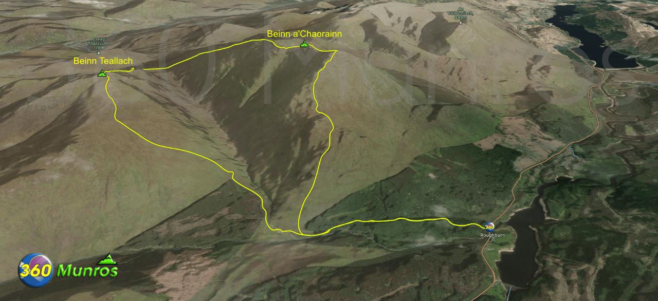
Maps - View - Print - GPX File Download
There has been some forestry work near the start of the route where it went through the trees. The path is more or less destroyed now so its best to stick with the road until out onto the hill – like the virtual tour above.
All routes on 360munros.co.uk are SUMMER Munro Bagging Routes.
Winter Munro routes with Ice/Snow can be extremely challenging and dangerous.
The downloading and use of GPX files or printing of maps from 360munros.co.uk by individuals or groups as a navigational aid is entirely at the risk of the user.
3D Model of Beinn a'Chaorainn and Beinn Teallach Area
3D model loading…… Internet speed dependant.
The red line on the 3D model shows the route.
Click on the 3D model to move around / zoom in out.
