Beinn Bhuidhe
"Yellow Hill"
A long, narrow Munro tucked deep in Glen Fyne, its name means Yellow Hill, reflecting the golden hues of its grassy slopes in summer light. The approach is lengthy, often following estate tracks before the climb steepens onto its ridge. Remote and less frequented than its neighbours, Beinn Bhuidhe rewards persistence with wide views across Argyll and a strong sense of solitude.
Route details with map, 3D model and GPX download of the route to the summit of this mountain in Scotland.
Munro – Beinn Bhuidhe – Altitude: 949 metres
From Alt na Lairig Power Station – Length: 7 miles Total Ascent: 3000 ft Surface: Moderate – Rough
Difficulty: Moderate/Some easy scrambling
Average Walking Time: 4:25 h
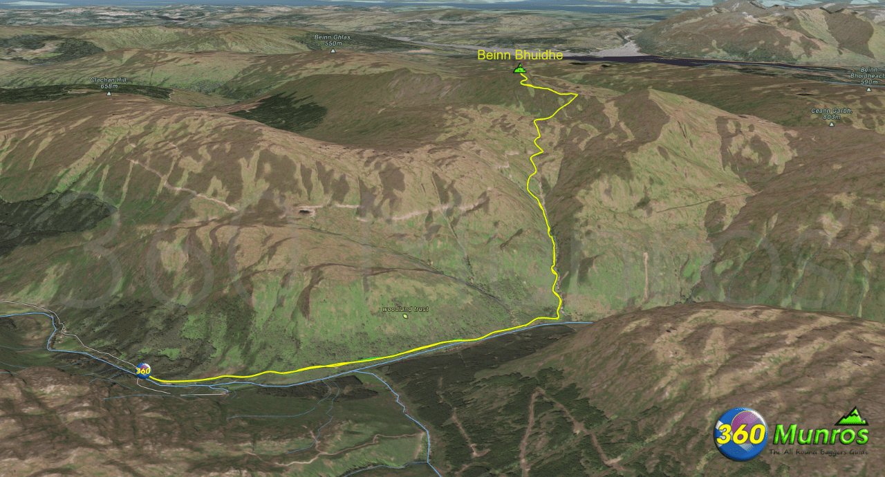
The route on our map starts just south of the Alt na Lairig Power Station.
Car parking is available beside the old bridge next to Inverfyne Cottage.
The route start is a fair distance away from the car park on a good tarmac road (local vehicle access only).
It’s probably best to cycle up Glen Fyne to the route start point. There is a bike rack at the end of the road to padlock bicycles onto.
Google maps directions to the route start can be found HERE
Beinn Bhuidhe
360° virtual tour
Click on the round 360 logo in the tour window below to move forward through the Munro route tour. Pan Around using your mouse or finger. Press the Map - Show/Hide button to see where you are on the route. The red photo location marker within the map points it's radar in the direction of the photos view. The compass within the tour window lets you know the direction of view and travel. If possible view on a VR Headset to feel like your there!
Maps - View - Print - GPX File Download
All routes on 360munros.co.uk are SUMMER Munro Bagging Routes.
Winter Munro routes with Ice/Snow can be extremely challenging and dangerous.
The downloading and use of GPX files or printing of maps from 360munros.co.uk by individuals or groups as a navigational aid is entirely at the risk of the user.
3D Model of Beinn Bhuidhe
3D model loading…… Internet speed dependant.
The red line on the 3D model below shows the route.
Click on the 3D model to move around / zoom in out.
