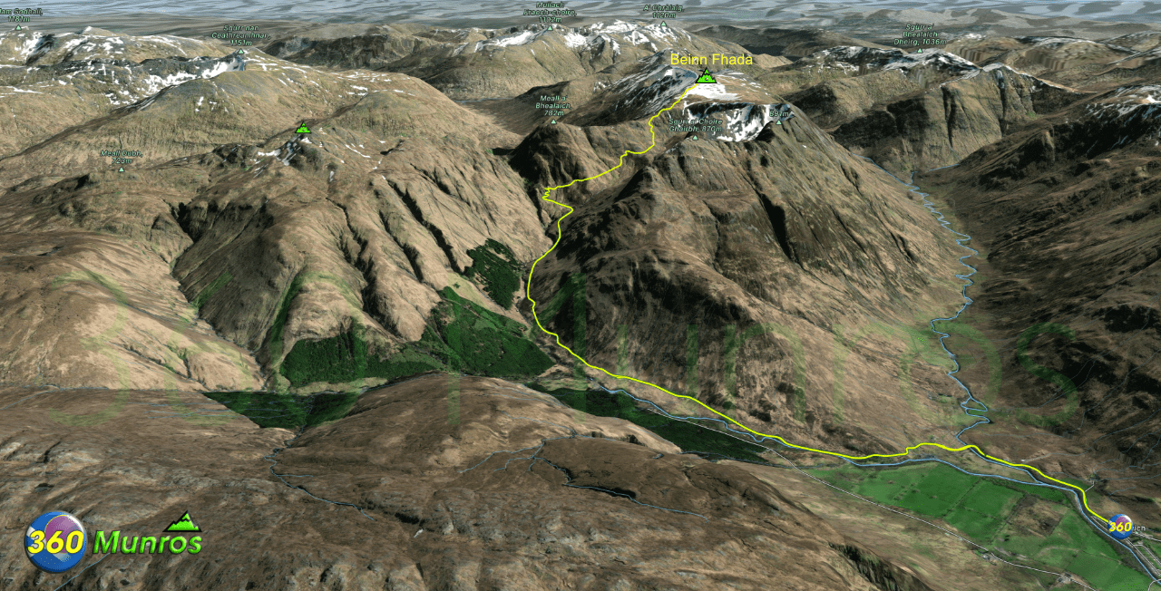
Beinn Fhada
"Long Mountain"
Route details with map, 3D model and GPX download of the route to the summit of this mountain in Scotland.
Munro – Beinn Fhada – Altitude: 1032 metres
Length: 11.5 miles Total Ascent: 3482 ft Surface: Rough
Difficulty: Moderate/Hard
Average Walking Time: 6:20 h
Could be combined with A’ Ghlas-bheinn. See virtual tour below
Route starts at Aultachruine, Kyle, IV40 8HN.
Google maps directions to the route start can be found HERE
Maps - View - Print - GPX File Download
All routes on 360munros.co.uk are SUMMER Munro Bagging Routes.
Winter Munro routes with Ice/Snow can be extremely challenging and dangerous.
The downloading and use of GPX files or printing of maps from 360munros.co.uk by individuals or groups as a navigational aid is entirely at the risk of the user.
Beinn Fhada & A' Ghlas-bheinn Route
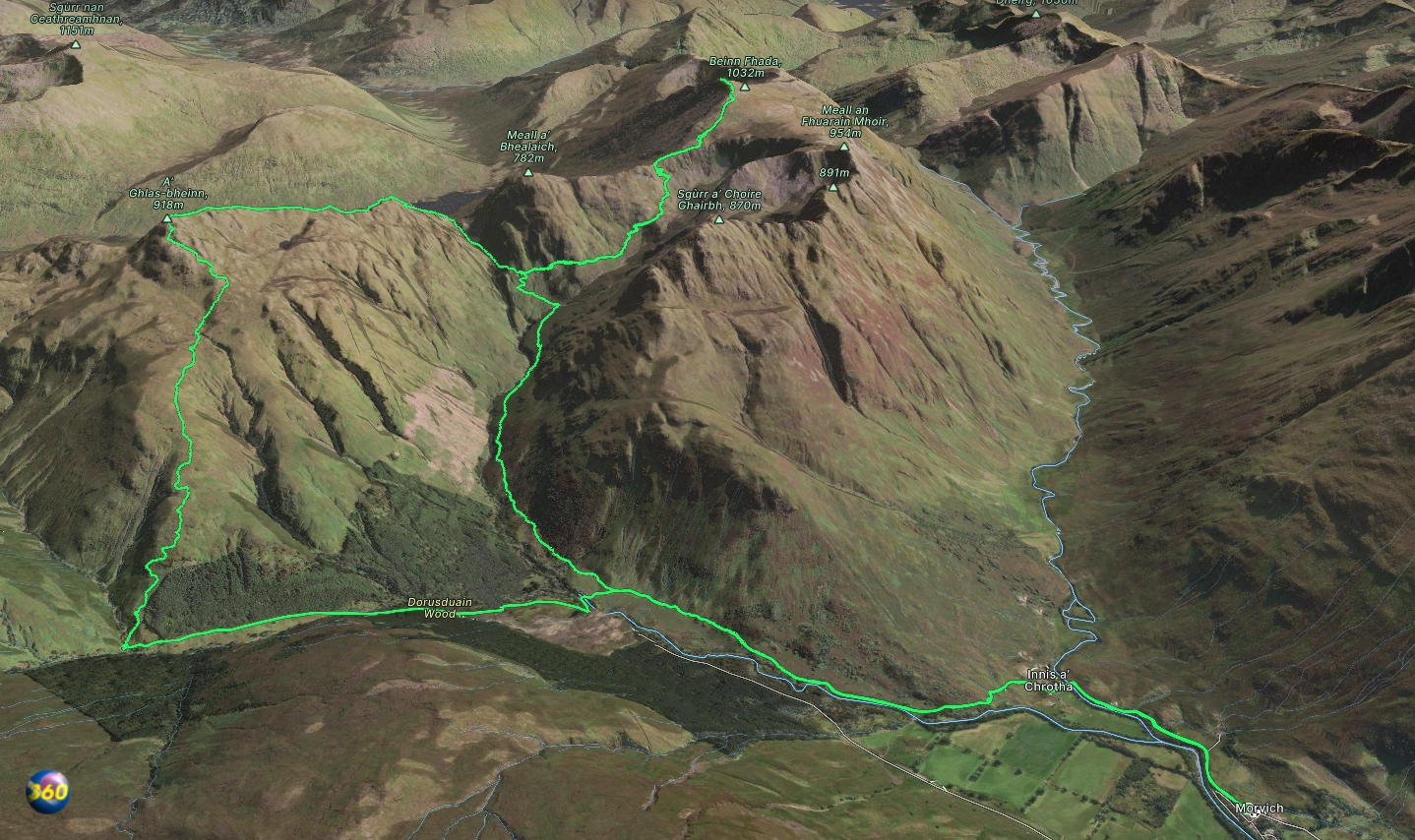
Length: 16.0 miles Total Ascent: 5020 ft Surface: Rough
Difficulty: Hard
Average Walking Time: 9:30 h
Beinn Fhada & A' Ghlas-bheinn
360° Virtual Tour
Click on the round 360 logo in the tour window below to move forward through the Munro route tour. Pan Around using your mouse or finger. Press the Map - Show/Hide button to see where you are on the route. The red photo location marker within the map points it's radar in the direction of the photos view. The compass within the tour window lets you know the direction of view and travel. If possible view on a VR Headset to feel like your there!
All routes on 360munros.co.uk are SUMMER Munro Bagging Routes.
Winter Munro routes with Ice/Snow can be extremely challenging and dangerous.
The downloading and use of GPX files or printing of maps from 360munros.co.uk by individuals or groups as a navigational aid is entirely at the risk of the user.
3D Model of Beinn Fhada
3D model loading…… Internet speed dependant.
The red line on the 3D model is the route.
Click on the 3D model to move around / zoom in out.
