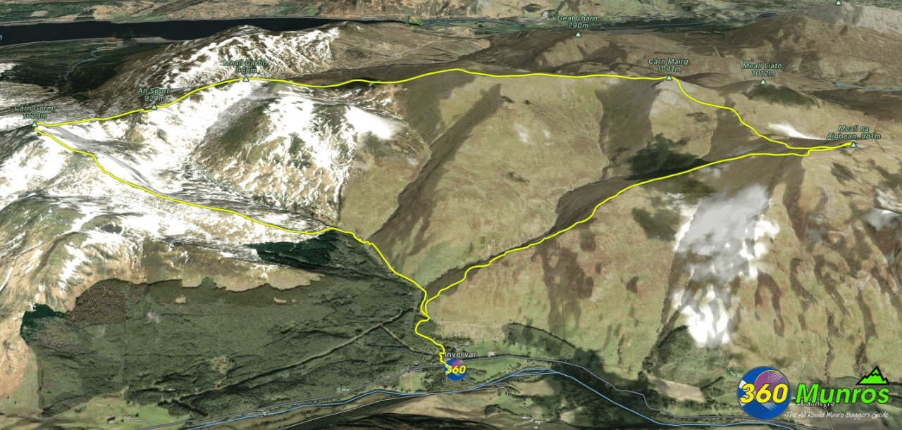
Càrn Gorm Munros
Route details with 360° virtual tour, map, 3D model and GPX download of the route to the summit of these mountains in Scotland.
Munro – Meall na Aighean (‘Hill of the Heifers or Hinds’) – Altitude: 981 metres
Munro – Càrn Mairg (‘Hill of Sorrow’) – Altitude: 1042 metres
Munro – Meall Garbh (‘Rough Hill’) – Altitude: 968 metres
Munro – Càrn Gorm (‘Blue Hill’) – Altitude: 1029 metres
Route Length: 11 miles Total Ascent: 4000 ft Surface: Rough/paths/grass/road
Difficulty: Moderate
Average Walking Time: 6:40 h
Route starts at Invervar, Aberfeldy PH15 2PL.
Google maps directions to the route start can be found HERE
Càrn Gorm Munros
360° Virtual Tour
The virtual tour below was done in an anti clockwise direction. Both directions are good walks. Like most routes – wind direction (getting it on your back) would be a deciding factor to which way the route was walked.
Click on the round 360 logo in the tour window below to move forward through the Munro route tour. Pan Around using your mouse or finger. Press the Map - Show/Hide button to see where you are on the route. The red photo location marker within the map points it's radar in the direction of the photos view. The compass within the tour window lets you know the direction of view and travel. If possible view on a VR Headset to feel like your there!
All routes on 360munros.co.uk are SUMMER Munro Bagging Routes.
Winter Munro routes with Ice/Snow can be extremely challenging and dangerous.
The downloading and use of GPX files or printing of maps from 360munros.co.uk by individuals or groups as a navigational aid is entirely at the risk of the user.
3D Model of the Càrn Gorm Munros
3D model loading…… Internet speed dependant.
The red line on the 3D model shows the route.
Click on the 3D model to move around / zoom in out.
