Maol Chean-dearg
"Bald Red Head"
Maol Cheann-Dearg is a Torridonian sandstone mountain in the Northwest Highlands of Scotland, between Upper Loch Torridon and Loch Carron.
Route details with map, 3D model and GPX download of the route to the summit of this mountain in Scotland.
Munro – Maol Chean-dearg – Altitude: 933 metres
Route Length: 10 miles Total Ascent: 3140 ft Surface: Paths/Scree
Difficulty: Moderate/Hard
Average Walking Time: 5:30 h
Route starts at Coulags bridge, Strathcarron.
Google maps directions to the route start can be found HERE
Maol Chean-dearg
360° Virtual Tour
Click on the round 360 logo in the tour window below to move forward through the Munro route tour. Pan Around using your mouse or finger. Press the Map - Show/Hide button to see where you are on the route. The red photo location marker within the map points it's radar in the direction of the photos view. The compass within the tour window lets you know the direction of view and travel. If possible view on a VR Headset to feel like your there!
Maps - View - Print - GPX File Download
All routes on 360munros.co.uk are SUMMER Munro Bagging Routes.
Winter Munro routes with Ice/Snow can be extremely challenging and dangerous.
The downloading and use of GPX files or printing of maps from 360munros.co.uk by individuals or groups as a navigational aid is entirely at the risk of the user.
3D Model of Maol Chean-dearg
3D model loading…… Internet speed dependant.
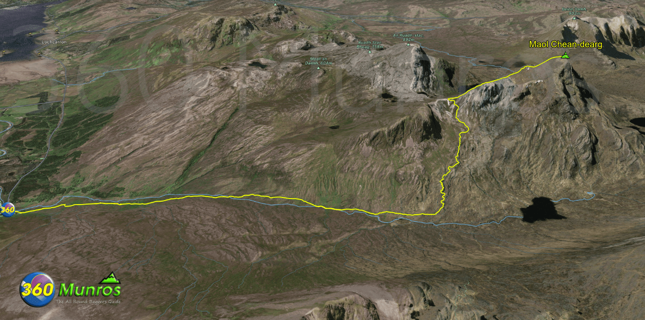
The red line on the 3D model shows the route.
Click on the 3D model to move around / zoom in out.
Panoramic Peakfinder
View looking from the top of Maol Chean-dearg. Pan around to view other peaks in the area.
