Inn Pinn & Sgùrr na Banachdaich
Inn Pinn – Altitude: 986 metres
Sgùrr na Banachdaich – Altitude: 965 metres
Route Length: 8.0 miles Total Ascent: 3600 ft Surface: Very Rough/Boulders/ Paths/Pathless
Difficulty: Hard/Exposed Scrambling and climbing
Route for very experienced Munro Baggers.
Walkers with no climbing experience should hire a mountain guide.
Average Walking Time: 5:45 h
Route starts at the Glen Brittle Memorial Hut car park. Isle of Skye
Google maps directions to the route start can be found HERE
Sgùrr Dearg & Sgùrr na Banachdaich
360° Virtual Tour
The VR Tour below gives an Idea of the route to the Inaccessible Pinnacle, Sgùrr Dearg, then on to Sgùrr na Banachdaich. It starts at Coireachan Ruadha Crags taking in a great scramble along the ridge.
Click on the round 360 logo in the tour window below to move forward through the Munro route tour. Pan Around using your mouse or finger. Press the Map - Show/Hide button to see where you are on the route. The red photo location marker within the map points it's radar in the direction of the photos view. The compass within the tour window lets you know the direction of view and travel. If possible view on a VR Headset to feel like your there!
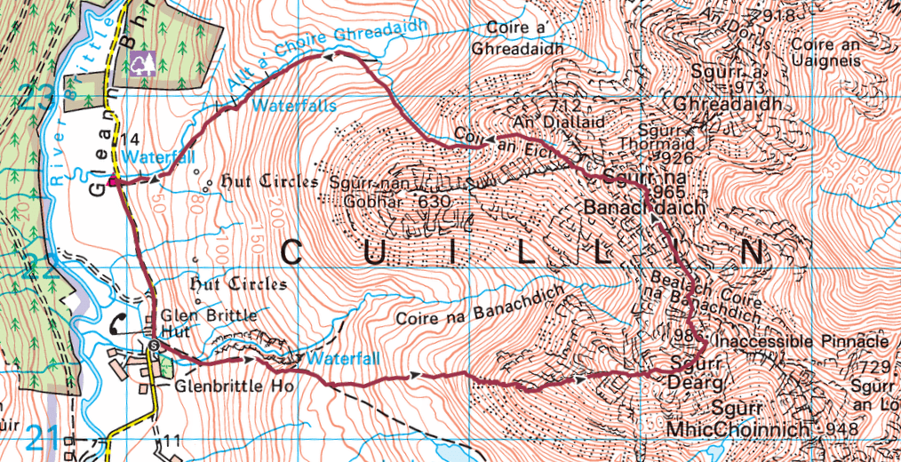
Inn Pinn & Sgùrr na Banachdaich OS Map
3D Model
Inn Pinn & Sgùrr na Banachdaich
3D model loading…… Internet speed dependant.
The red line on the 3D model below shows the route.
Click on the 3D model to move around / zoom in out.
