Stob a'Choire Odhair & Stob Ghabhar
‘Peak of the Dun-Coloured Corrie’ & ‘Goats Peak’
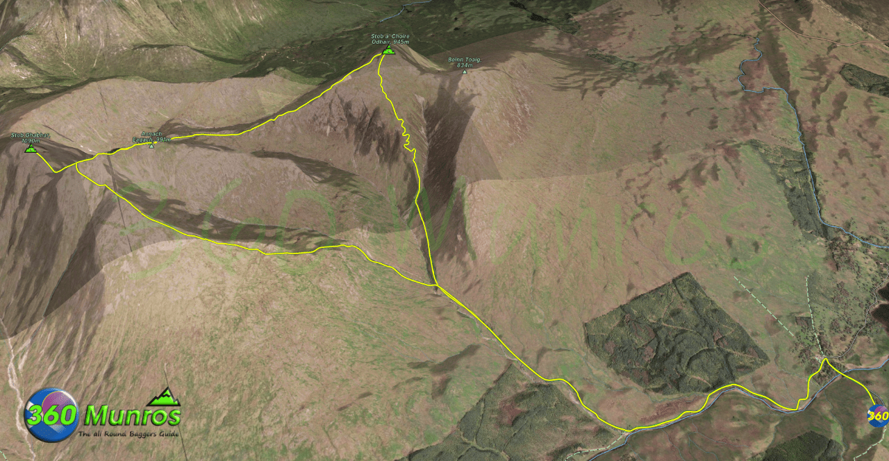
Route details with map, 3D model and GPX download of the route to the summit of these mountains in Scotland.
Munro – Stob a’Choire Odhair – Altitude: 945 metres
Munro – Stob Ghabhar – Altitude: 1090 metres
Length: 10.2 miles Total Ascent: 3905 ft Surface: Very Rough/Some easy scrambling
Difficulty: Hard
Average Walking Time: 6:00 h
Route starts at Victoria Bridge Car Park, Bridge of Orchy PA36 4AH.
Google maps directions to the route start can be found HERE
Stob a'Choire Odhair & Stob Ghabhar
360° Virtual Tour
This virtual tour gives a good example of how the weather can change in the Scottish mountains within a short period. Documented visual proof that the Munro Bagger should be properly prepared with good equipment, suitable clothing and have the ability to navigate in poor visibility. We started this route in sunny conditions with a weather forecast predicting the conditions to stay stable. We climbed Stob a’Choire Odhair, by the time we headed out to Stob Ghabhar, bad weather was setting in, halfway up and the visibility was very poor with driving rain, wind and a low cloud base.
Click on the round 360 logo in the tour window below to move forward through the Munro route tour. Pan Around using your mouse or finger. Press the Map - Show/Hide button to see where you are on the route. The red photo location marker within the map points it's radar in the direction of the photos view. The compass within the tour window lets you know the direction of view and travel. If possible view on a VR Headset to feel like your there!
Maps - View - Print - GPX File Download
All routes on 360munros.co.uk are SUMMER Munro Bagging Routes.
Winter Munro routes with Ice/Snow can be extremely challenging and dangerous.
The downloading and use of GPX files or printing of maps from 360munros.co.uk by individuals or groups as a navigational aid is entirely at the risk of the user.
3D Model of Stob Ghabhar and Stob a'Choire Odhair
3D model loading…… Internet speed dependant.
The red line on the 3D model shows the route.
Click on the 3D model to move around / zoom in out.
