Aonach Beag & Aonach Mòr
‘Small Ridge’ & ‘Big Ridge’
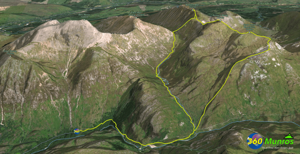
Following the Eas an Tuill path from the Upper Glen Nevis car park to the Steall ruins. Turn north up the steep climb handrailing the Allt Coire Giubhsachan burn all the way to the Col at Coire Giubhsachan. From here its West up another very steep climb to the Saddle at Seang Aonach Mor. The two Munros are fairly accessable from here. The descent from Aonach Mòr via Stob Coire Bhealaich is pretty much pathless and good navigational skills would be required in adverse conditions.
Route details with 360° virtual tour, map, 3D model and GPX download of the route to the summit of these mountains in Scotland.
Aonach Mòr – Altitude: 1221 metres
Aonach Beag – Altitude: 1234 metres
Route Length: 11 miles Total Ascent: 4500 ft Surface: Rough/paths
Difficulty: Hard
Average Walking Time: 6:30 h
Route starts at the Upper Glen Nevis Car Park, Fort William, PH33 6SY.
Google maps directions to the route start can be found HERE
Aonach Beag & Aonach Mòr
360° Virtual Tour
Ramsay’s Round virtual tour.
360° photos of Aonach Mòr & Aonach Beag Munros are on the tour below.
Click on the round 360 logo in the tour window below to move forward through the Munro route tour. Pan Around using your mouse or finger. Press the Map - Show/Hide button to see where you are on the route. The red photo location marker within the map points it's radar in the direction of the photos view. The compass within the tour window lets you know the direction of view and travel. If possible view on a VR Headset to feel like your there!
Maps - View - Print - GPX File Download
3D Model of Aonach Beag & Aonach Mòr
3D model loading…… Internet speed dependant.
The red line on the 3D model shows the route.
Click on the 3D model to move around / zoom in out.
