Arrochar Alp Munros
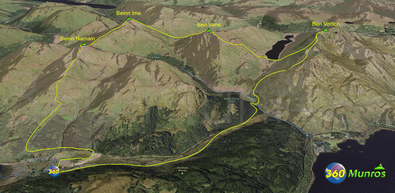
The route shown above and below follows the Arrochar Alps hill race lines.
This makes for a great hiking route for those wanting to bag all the Arrochar Alp Munros in one go.
It’s a very tough route with big steep climbs and descents. Be prepared to navigate if the weather is bad.
This route is suitable for Experienced hill runners and walkers.
The route below is pretty good, it gives a fairly accurate idea of the racing route – NOT EXACT RACING LINES. On the day of taking photos there was quite a bit of snow in the corrie to the East of Beinn Ime so we climbed the north face from Glas-Bhealach, when doing the race we ascend via the north east side of the corrie to the summit.
Arrochar Alp Munros
Munro – Ben Vorlich -Altitude: 943m
Munro – Ben Vane – Altitude: 916m
Munro – Beinn Ime – Altitude: 1011m
Munro – Beinn Narnain – Altitude: 927m
Route starts – Loch Long Car Park and Picnic Area, A83, Arrochar G83 7AN
Route Length: 16 miles Total Ascent: 7500 ft Surface: Rough/Path/Pathless/steep descents & accents
Difficulty: Very Hard
Average Walking Time: 10.00 h
There are plenty of car parking spaces at Loch Long car park.
Beware – this car park is operated by a private firm, they use number plate recognition cameras.
They issue fines in the post for non payment or staying over your paid for time.
Google maps directions to the route start can be found HERE
Arrochar Alps Hill Race
360° Virtual Tour
Click on the round 360 logo in the tour window below to move forward through the Munro route tour. Pan Around using your mouse or finger. Press the Map - Show/Hide button to see where you are on the route. The red photo location marker within the map points it's radar in the direction of the photos view. The compass within the tour window lets you know the direction of view and travel. If possible view on a VR Headset to feel like your there!
All routes on 360munros.co.uk are SUMMER Munro Bagging Routes.
Winter Munro routes with Ice/Snow can be extremely challenging and dangerous.
The downloading and use of GPX files or printing of maps from 360munros.co.uk by individuals or groups as a navigational aid is entirely at the risk of the user.
Arrochar Alps 3D Model View
3D model loading…… Internet speed dependant.
The red line on the 3D model shows the route.
Click on the 3D model to move around / zoom in out.
