Beinn Bhrotain & Monadh Mor
‘Hill of the Mastiff’ & ‘The Big Hill’
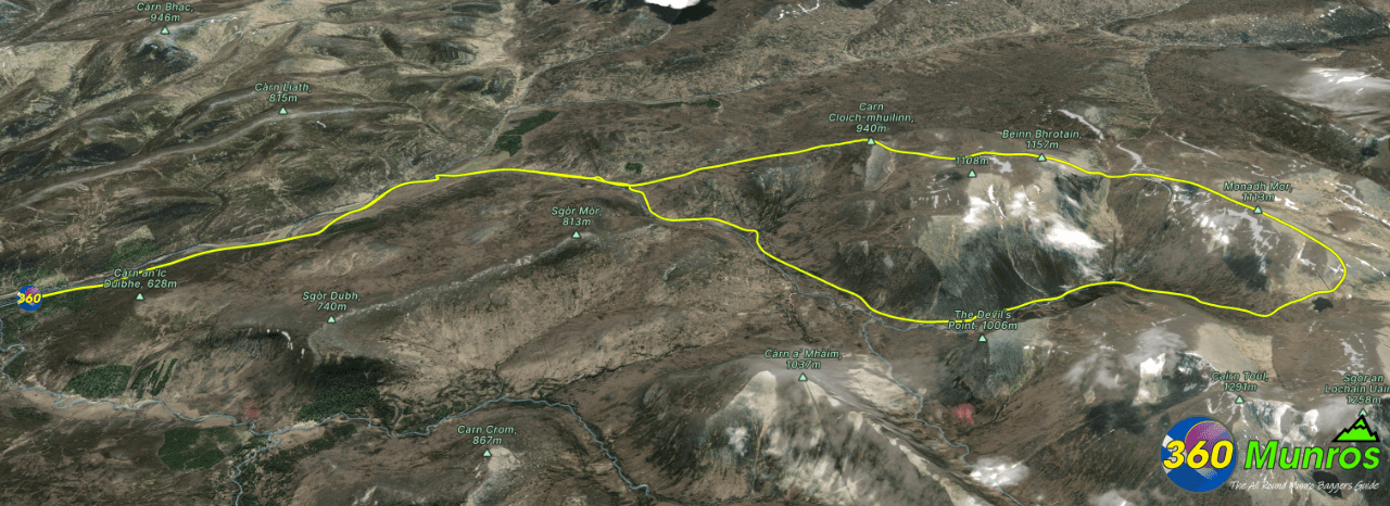
Route details with 360° virtual tour, map, 3D model and GPX download of the route to the summit of these mountains in Scotland.
Munro – Beinn Bhrotain – Altitude: 1157 metres
Munro – Monadh Mor – Altitude: 1115 metres
Route Length: 21.6 miles Total Ascent: 3388 ft Surface: Rough/paths/pathless/road/
Difficulty: Hard
Average Walking Time: 12:00 h
A considerable amount of time could be saved by using a MTB and cycling in.
Route starts at the Linn of Dee Car Park, Braemar, Ballater AB35 5YJ
Google maps directions to the route start can be found HERE
Beinn Bhrotain & Monadh Mor
360° Virtual Tour
Click on the round 360 logo in the tour window below to move forward through the Munro route tour. Pan Around using your mouse or finger. Press the Map - Show/Hide button to see where you are on the route. The red photo location marker within the map points it's radar in the direction of the photos view. The compass within the tour window lets you know the direction of view and travel. If possible view on a VR Headset to feel like your there!
Loading...
Maps - View - Print - GPX File Download
3D Model of Beinn Bhrotain & Monadh Mor
3D model loading…… Internet speed dependant.
Click on the 3D model to move around / zoom in out.
