Beinn Eighe
"Big Red Stack"
A complex mountain massif in the Torridon area of Wester Ross in the Highlands of Scotland. Lying to the south of Loch Maree, it forms a long ridge with many spurs and summits, two of which are classified as Munros. The name Beinn Eighe comes from the Scottish Gaelic meaning File Mountain. Unlike most other hills in the area it has a cap of Cambrian basal quartzite which gives the peaks of Beinn Eighe a distinctive light colour. Its complex topography has made it popular with both hillwalkers and climbers and the national nature reserve on its northern side makes it an accessible mountain for all visitors.
Route details with 360° virtual tour, map, 3D model and GPX download of the route to the summit of these mountains in Torridon, Scotland.
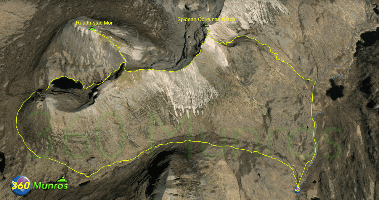
Spidean Coire nan Clach – Altitude: 993 metres
Ruadh-stac Mor – Altitude: 1010 metres
Route Length: 11.5 miles Total Ascent: 3900 ft Surface: Rough/Boulders/paths
Difficulty: Moderate/Hard/Some Easy Scrambling
Average Walking Time: 6:30 h
Route starts at Beinn Eighe car park (Torridon), Achnasheen IV22 2ET.
Google maps directions to the route start can be found HERE
Beinn Eighe
360° Virtual Tour
Click on the round 360 logo in the tour window below to move forward through the Munro route tour. Pan Around using your mouse or finger. Press the Map - Show/Hide button to see where you are on the route. The red photo location marker within the map points it's radar in the direction of the photos view. The compass within the tour window lets you know the direction of view and travel. If possible view on a VR Headset to feel like your there!
Maps - View - Print - GPX File Download
All routes on 360munros.co.uk are SUMMER Munro Bagging Routes.
Winter Munro routes with Ice/Snow can be extremely challenging and dangerous.
The downloading and use of GPX files or printing of maps from 360munros.co.uk by individuals or groups as a navigational aid is entirely at the risk of the user.
3D Model of Beinn Eighe
3D model loading…… Internet speed dependant.
The red line on the 3D model below shows the route.
Click on the 3D model to move around / zoom in out.
