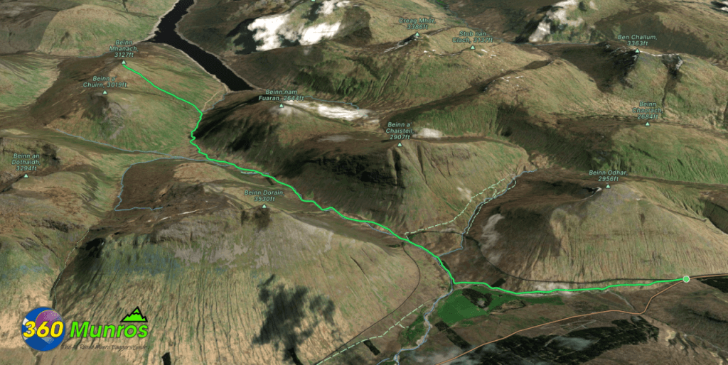
Beinn Mhanach
‘Monk Mountain’
Route details with map, 3D model and GPX download of the route to the summit of this mountain in Scotland.
Munro – Beinn Mhanach – Altitude: 953 metres
Length: 13.6 miles Total Ascent: 2982 ft Surface: Rough
Difficulty: Moderate
Average Walking Time : 6:45 h
The foot of Beinn Mhanach is quite far in at the end of a dirt track.
Using a mountain bike in and out this dirt track section would save considerable time.
Route starts at a small car park on the A82 north of Tyndrum.
Google maps directions to the route start can be found HERE
360° Virtual Tour of this area coming soon.
Maps - View - Print - GPX File Download
All routes on 360munros.co.uk are SUMMER Munro Bagging Routes.
Winter Munro routes with Ice/Snow can be extremely challenging and dangerous.
The downloading and use of GPX files or printing of maps from 360munros.co.uk by individuals or groups as a navigational aid is entirely at the risk of the user.
3D Model of Beinn Mhanach
3D model loading…… Internet speed dependant.
The red line on the 3D model below shows the route.
Click on the 3D model to move around / zoom in out.
Beinn Mahanich, Beinn a'Chreachain & Beinn Achaladair
Although quite a big day out, Beinn Mahanich can be done in conjunction with Beinn a’Chreachain & Beinn Achaladair.
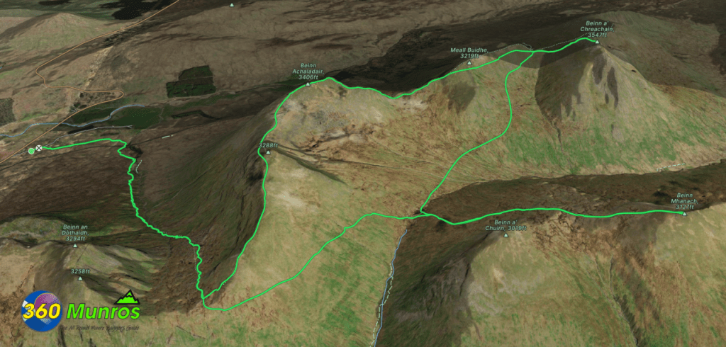
Munro – Beinn Mahanich – Altitude: 953 meters
Munro – Beinn a’Chreachain – Altitude: 1081 metres
Munro – Beinn Achaladair – Altitude: 1038 metres
Length: 17 miles Total Ascent: 5400 ft Surface: Rough/Steep/Bog/Grass/Path/Pathless
Difficulty: Very Hard
Average Walking Time: 10:00 h
Route starts at a car park on a small road that leaves the A82 at the north end of Loch Tulla to Achallader, PA36 4AG.
Google maps directions to the route start can be found HERE
360° Virtual Tour of this area coming soon.
All routes on 360munros.co.uk are SUMMER Munro Bagging Routes.
Winter Munro routes with Ice/Snow can be extremely challenging and dangerous.
The downloading and use of GPX files or printing of maps from 360munros.co.uk by individuals or groups as a navigational aid is entirely at the risk of the user.
