Ben More and Stob Binnein
‘Big Mountain’ & ‘Conical Peak’
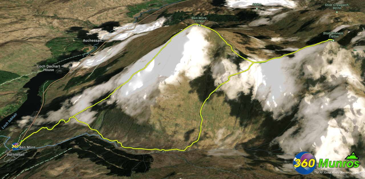
Ben More is a Munro in the southern Highlands of Scotland, near Crianlarich. It is the highest of the Crianlarich Hills.
Route details with 360° virtual tour, map, 3D model and GPX download of the route to the summit of these mountains in Scotland.
Munro – Ben More – Altitude: 1174 metres
Munro – Stob Binnein – Altitude: 1165 metres
Route Length: 6.6 miles Total Ascent: 4190 ft Surface: Rough/paths/road
Difficulty: Moderate/ Very Steep climb
Average Walking Time: 4:45 h
Route starts at Ben More Trail Head, A85, Crianlarich FK20 8QS
Ben More Webcam can be found HERE
Google maps directions to the route start can be found HERE
Ben More and Stob Binnein 360° Virtual Tour
360° photographic virtual tour to these mountains from Ben More Farm, Crianlarich, Scotland.
Click on the round 360 logo in the tour window below to move forward through the Munro route tour. Pan Around using your mouse or finger. Press the Map - Show/Hide button to see where you are on the route. The red photo location marker within the map points it's radar in the direction of the photos view. The compass within the tour window lets you know the direction of view and travel. If possible view on a VR Headset to feel like your there!
Maps - View - Print - GPX File Download
Ben More & Stob Binnein -3D Model View
The red line on the model below shows the route.
Zoom in / out and pan around the 3D Image below.
Can take a few seconds to load.
