Ben Nevis
"Mountain with its Head in the Clouds"
The UK'S Highest
Ben Nevis – Altitude: 1345 metres - 4,413ft
“The Ben” as it’s known by the locals is a collapsed dome of an ancient volcano and at 1,345m (4,413ft) high is the highest land in any direction for 459 miles.
A very popular mountain with over 150k ascents every year. Ben Nevis is probably the most climbed Munro.
Below are route details – 360° virtual tours, OS maps, 3D model and GPX downloads for the routes to the summit of Ben Nevis.
Ben Nevis Via The Mountain Path
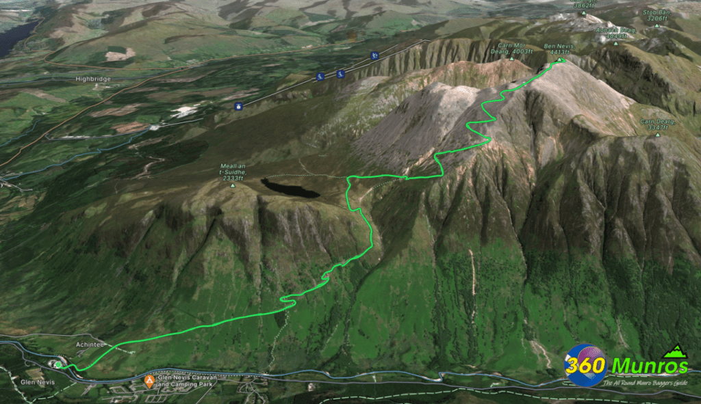
The Mountain Path is the most popular and easiest way to climb Ben Nevis
Route Length: 9.8 miles Total Ascent: 4454 ft Surface: Rough/Path
Difficulty: Moderate/Hard
Average Walking Time: 6:20 h
Route starts at the Ben Nevis Visitor Centre, Glen Nevis, Fort William PH33 6PF.
There are plenty of car parking spaces at the visitor centre.
Google maps directions to the route start can be found HERE
The Mountain Path
360° Virtual Tour
Welcome to our virtual tour of Ben Nevis via the mountain path, the highest mountain in the British Isles!
We will begin our tour at the base of the mountain, located in Fort William, Scotland. From here, we will take a virtual hike up the mountain path and explore its breathtaking views.
As we start our climb, we will encounter a well-marked trail that winds its way up the mountain. The trail is relatively steep, but it is well-maintained, and there are several places to stop and rest along the way.
As we continue our ascent, we will pass through several different types of terrain. We will begin in a wooded area with tall trees and lush vegetation. As we climb higher, the trees will thin out, and we will find ourselves on a rocky slope. Finally, we will reach the peak, which is a rocky, windswept plateau with stunning views of the surrounding mountains and valleys.
From the summit, we will be able to see for miles in every direction. On a clear day, we will be able to see the Isle of Skye, the Cuillin Mountains, and the West Highland Way. To the south, we will see the Glencoe Mountains, and to the north, we will see the Great Glen and Loch Ness.
The descent will be just as spectacular as the ascent, with panoramic views of the valley and surrounding countryside. We will finish our virtual tour back at the base of the mountain in Fort William, Scotland.
Thank you for joining 360 Munros on this virtual tour of Ben Nevis. We hope you enjoy the experience, and we encourage you to visit in person to witness the beauty of this magnificent mountain for yourself.
Click on the round 360 logo in the tour window below to move forward through the Munro route tour. Pan Around using your mouse or finger. Press the Map - Show/Hide button to see where you are on the route. The red photo location marker within the map points it's radar in the direction of the photos view. The compass within the tour window lets you know the direction of view and travel. If possible view on a VR Headset to feel like your there!
The Mountain Path OS Route Map
All routes on 360munros.co.uk are SUMMER Munro Bagging Routes.
Winter Munro routes with Ice/Snow can be extremely challenging and dangerous.
The downloading and use of GPX files or printing of maps from 360munros.co.uk by individuals or groups as a navigational aid is entirely at the risk of the user.
Ben Nevis Via The Ledge Route
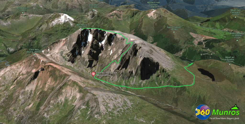
The Ledge Route
360° Virtual Tour
This route is classed as a summer grade 1-2 scramble.
For the more adventurous hiker this is a great North Face route to take to the summit of Ben Nevis.
Below is a 360 virtual tour of the Ledge Route up Ben Nevis.
Click on the round 360 logo in the tour window below to move forward through the Munro route tour. Pan Around using your mouse or finger. Press the Map - Show/Hide button to see where you are on the route. The red photo location marker within the map points it's radar in the direction of the photos view. The compass within the tour window lets you know the direction of view and travel. If possible view on a VR Headset to feel like your there!


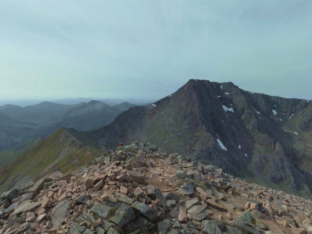
Càrn Mòr Dearg Arête Route
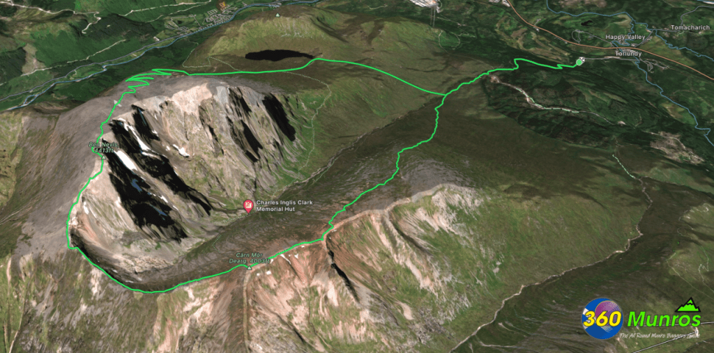
This route bags 2 Munros and makes a great Arête walk from Munro Càrn Mòr Dearg to the summit of Ben Nevis.
Càrn Mòr Dearg – Altitude: 1220 metres
Ben Nevis – Altitude: 1345 metres
Route Length: 11 miles Total Ascent: 4826 ft Surface: Rough/Boulder Fields/Path/Pathless/Ridge
Difficulty: Moderate/Hard
Some easy scrambling on Càrn Mòr Dearg Arête during Summer conditions.
Average Walking Time: 7:00 h
Càrn Mòr Dearg Arête
360° Virtual Tour
Càrn Mòr Dearg Arête OS Route Map
Ben Nevis 3D Model View
Zoom in / out and pan around the 3D Image of Ben Nevis below.
Can take a few seconds to load.
