Ben Vane
"Middle Mountain"
Ben Vane from Inverglus
Ben Vane is a compact yet rugged Munro located in the Arrochar Alps, Loch Lomond and The Trossachs National Park.
Though it only just qualifies as a Munro at 916 metres (3,002 ft), it offers a surprisingly steep and challenging ascent.
One of the smallest Munros by elevation.
Despite its modest height, the climb is strenuous, with an elevation gain of around 1000 meters.
Steep, rocky slopes with several false summits and mild scrambling near the top.
Often climbed as a standalone peak or along with neighbouring Ben Vorlich.
The most common route starts from Inveruglas Visitor Centre, following the road past the Sloy Hydro-Electric Power Station then under the railway, following the road to the base of the mountain. See map and virtual tour below.
The summit offers panoramic views of Loch Lomond and surrounding peaks like Beinn Ìme and Ben Vorlich.
Ben Vane – Altitude: 916 metres
Route Length: 6 miles Total Ascent: 2830 ft Surface: Rough/Paths/Rocky
Difficulty: Moderate/Steep
Average Walking Time: 4:00 h
This route starts at Inveruglas. There is parking at Inveruglas visitor centre.
Google maps directions HERE
Ben Vane from Inverglus
360° Virtual Tour
Click on the round 360 logo in the tour window below to move forward through the Munro route tour. Pan Around using your mouse or finger. Press the Map - Show/Hide button to see where you are on the route. The red photo location marker within the map points it's radar in the direction of the photos view. The compass within the tour window lets you know the direction of view and travel. If possible view on a VR Headset to feel like your there!
Maps - View - Print - GPX File Download
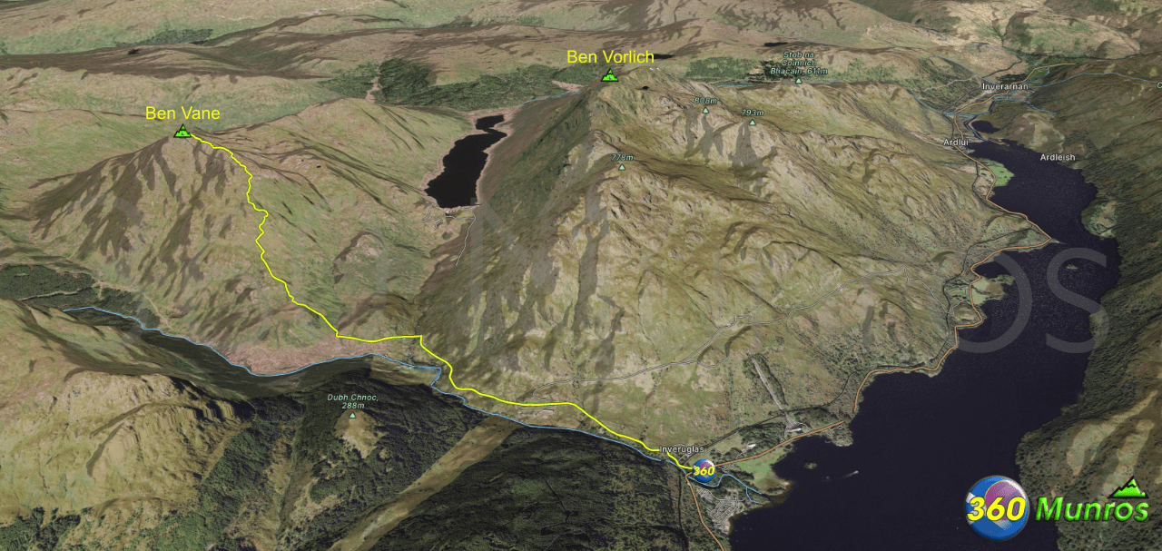
Ben Vane & Ben Vorlich

Ben Vane and Ben Vorlich Munros can be climbed together from Inverglus. The above image and map below show the route.
Ben Vorlich – Altitude: 943metres
Route Length: 11 miles Total Ascent: 5500 ft Surface: Rough/Paths/Rocky
Difficulty: Moderate/Hard/Steep
Average Walking Time: 7:20 h
Maps - View - Print - GPX File Download
Arrochar Alps 360° Virtual Tour
Ben Vane and Ben Vorlich can be climbed along with the other Munros in Arrochar. A 360° Virtual Tour and details of this route can be viewed on the Arrochar Alps page HERE
3D Model of Ben Vane & Ben Vorlich
3D model loading…… Internet speed dependant.
The red line on the 3D model shows the Ben Vane & Ben Vorlich route.
Click on the 3D model to move around / zoom in out.
