Càrn Mòr Dearg
‘Great Red Peak’
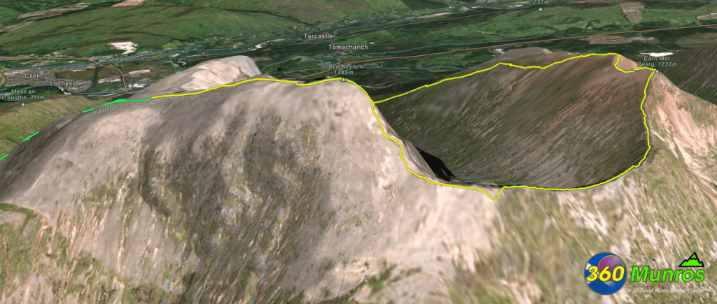
Can be climbed on its own via the North face trail and back. A more interesting route would be to combine Càrn Mòr Dearg with a great summer scramble/walk along Càrn Mòr Dearg Arête to the summit of the UK’S highest mountain Ben Nevis.
Route details with 360° virtual tour, map, 3D model and GPX download of the route to the summit of this mountain in Scotland.
Càrn Mòr Dearg – Altitude: 1220 metres
Straight Up & Down Route
Route Length: 7.7 miles Total Ascent: 3865 ft Surface: Rough/paths
Difficulty: Moderate
Average Walking Time: 5:15 h
OS Route Map View/Print HERE
Càrn Mòr Dearg – Càrn Mòr Dearg Arête – Ben Nevis
Route Length: 11 miles Total Ascent: 4826 feet Surface: Rough/Boulder Fields/Path/Pathless/Ridge
Difficulty: Moderate/Hard
Some easy scrambling on Càrn Mòr Dearg Arête during Summer conditions.
Average Walking Time: 7:00 h
OS Route Map View/Print HERE
Route starts at The North Face Trail, Ben Nevis, Torlundy, Fort William PH33 6SR.
Google maps directions to the route start can be found HERE
360° virtual tour
Càrn Mòr Dearg & Càrn Mòr Dearg Arête on Ramsay’s Round tour.
Click on the round 360 logo in the tour window below to move forward through the Munro route tour. Pan Around using your mouse or finger. Press the Map - Show/Hide button to see where you are on the route. The red photo location marker within the map points it's radar in the direction of the photos view. The compass within the tour window lets you know the direction of view and travel. If possible view on a VR Headset to feel like your there!
Maps - View - Print - GPX File Download
3D Model of Ben Nevis & Càrn Mòr Dearg
3D model loading…… Internet speed dependant.
Click on the 3D model to move around / zoom in out.
