Conival & Ben More Assynt
‘Hill of Meeting’ & ‘Big Mountain of Assynt’
Mountains in Assynt, these Munros sit in the far north-west of Scotland, 30 kilometres (19 miles) north-northeast of Ullapool. Ben More Assynt translates as “big mountain of Assynt”, and is the highest point in Sutherland.
Conival and Ben More Assynt are the only two Munros in the Assynt region of the north-western Scottish Highlands. They’re connected by a rocky ridge and offer a dramatic and rewarding hike through a remote and geologically fascinating landscape.
Route details with 360° virtual tour, map, 3D model and GPX download of the route to the summit of these mountains in Scotland.
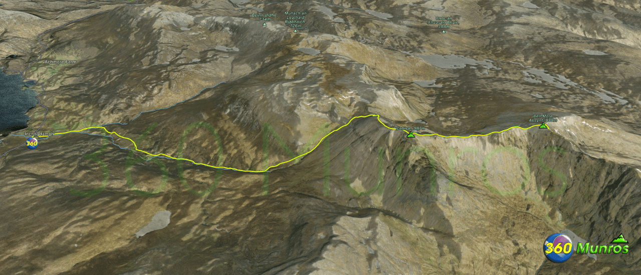
Munro – Conival – Altitude: 987 metres
Munro – Ben More Assynt – Altitude: 998 metres
Route Length: 11 miles Total Ascent: 3700 ft Surface: Rough/Boulders/paths
Difficulty: Moderate/Hard
Average Walking Time: 6:25 h
Route starts at Inchnadamph, Rock Trail Car Park, Lairg IV27 4HN.
Google maps directions to the route start can be found HERE
There is a site of Special Scientific Interest called The Bone Caves just off the lower trail to Conival. As well as animal bones – ancient human remains were discovered in the caves. May be worth a visit. More information is available HERE
Conival & Ben More Assynt
360° Virtual Tour
Click on the round 360 logo in the tour window below to move forward through the Munro route tour. Pan Around using your mouse or finger. Press the Map - Show/Hide button to see where you are on the route. The red photo location marker within the map points it's radar in the direction of the photos view. The compass within the tour window lets you know the direction of view and travel. If possible view on a VR Headset to feel like your there!
Maps - View - Print - GPX File Download
All routes on 360munros.co.uk are SUMMER Munro Bagging Routes.
Winter Munro routes with Ice/Snow can be extremely challenging and dangerous.
The downloading and use of GPX files or printing of maps from 360munros.co.uk by individuals or groups as a navigational aid is entirely at the risk of the user.
3D Model of
Conival & Ben More Assynt
3D model loading…… Internet speed dependant.
The red line on the 3D model shows the route.
Click on the 3D model to move around / zoom in out.
