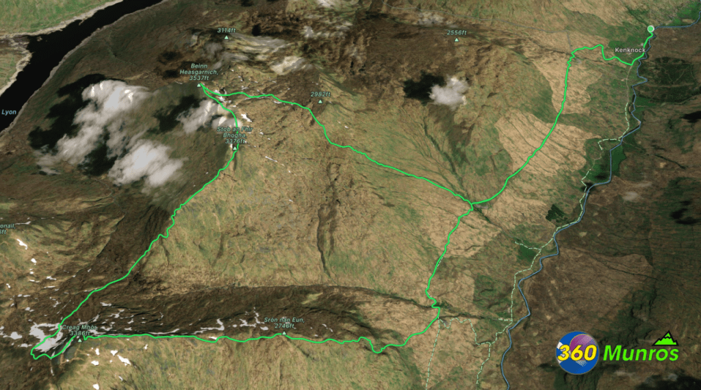
Creag Mhòr & Beinn Heasgarnich
Route details with map, 3D model and GPX download of the route to the summit of these mountains in Scotland.
Creag Mhòr – Altitude: 1047 metres
Beinn Heasgarnich – Altitude: 1078 metres
Length: 15.7 miles Total Ascent: 4360 ft Surface: Rough/Craggy/Boggy
Difficulty: Hard/Large pathless sections, good navigation skills required.
Time could be saved by using a MTB on the road in and out.
Average Walking Time: 8:30 h
Route starts at Glen Lochay car park just east of Kenknock, Killin, FK21 8UB.
Google maps directions to the route start can be found HERE
Creag Mhòr & Beinn Heasgarnich
360° Virtual Tour
Click on the round 360 logo in the tour window below to move forward through the Munro route tour. Pan Around using your mouse or finger. Press the Map - Show/Hide button to see where you are on the route. The red photo location marker within the map points it's radar in the direction of the photos view. The compass within the tour window lets you know the direction of view and travel. If possible view on a VR Headset to feel like your there!
Maps - View - Print - GPX File Download
All routes on 360munros.co.uk are SUMMER Munro Bagging Routes.
Winter Munro routes with Ice/Snow can be extremely challenging and dangerous.
The downloading and use of GPX files or printing of maps from 360munros.co.uk by individuals or groups as a navigational aid is entirely at the risk of the user.
3D Model of Creag Mhòr & Beinn Heasgarnich
3D model loading…… Internet speed dependant.
The red line on the 3D model shows the route.
Click on the 3D model to move around / zoom in out.
