Gairich, Loch Cuaich
“Garry’s Peak”
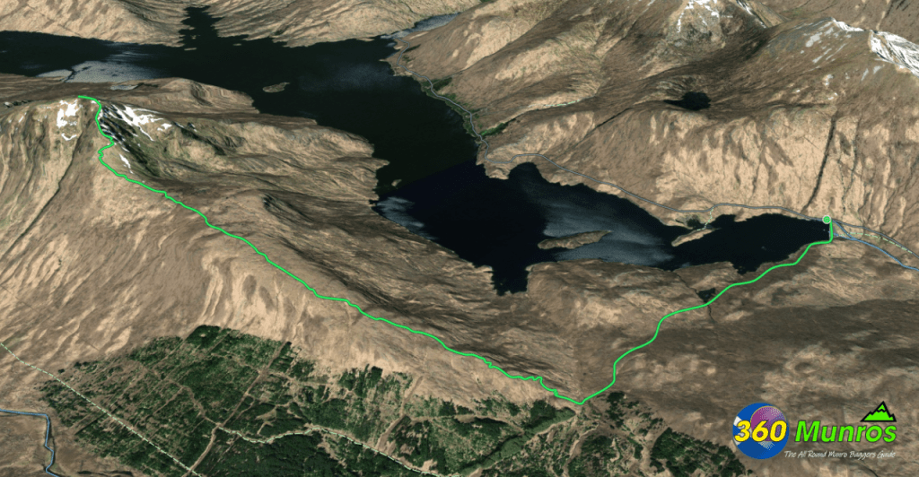
A solitary Munro rising above the waters of Loch Cuaich, Gairich offers a long, boggy approach and a steep ridge climb. Its summit rewards persistence with sweeping views into Knoydart and across the wild Highlands, making it a memorable outing in one of Scotland’s most remote corners.
Route details with map, 3D model and GPX download of the route to the summit of this mountain in Scotland.
Munro – Gairich – Altitude: 919 metres
Route Length: 10 miles Total Ascent: 2800 ft Surface: Rough/Paths/Bog
Difficulty: Moderate/Hard/Small easy scramble section
Route starts Loch Quoich dam, Invergarry.
Google maps directions to the route start can be found HERE
Gairich
360° Virtual Tour
Click on the round 360 logo in the tour window below to move forward through the Munro route tour. Pan Around using your mouse or finger. Press the Map - Show/Hide button to see where you are on the route. The red photo location marker within the map points it's radar in the direction of the photos view. The compass within the tour window lets you know the direction of view and travel. If possible view on a VR Headset to feel like your there!
Maps - View - Print - GPX File Download
All routes on 360munros.co.uk are SUMMER Munro Bagging Routes.
Winter Munro routes with Ice/Snow can be extremely challenging and dangerous.
The downloading and use of GPX files or printing of maps from 360munros.co.uk by individuals or groups as a navigational aid is entirely at the risk of the user.
3D Model of Gairich, Loch Quoich
3D model loading…… Internet speed dependant.
Click on the 3D model to move around / zoom in out.
