Glas Tulaichean, Carn an Righ & Beinn lutharn Mhor
‘Grey Hillocks’ - ‘Cairn of the King’ - ‘Big Sharp Ridge Hill’
Route details with a 360° virtual tour, map, 3D model and GPX download of the route to the summit of these mountains in Scotland.
Munro – Glas Tulaichean – Altitude: 1051 metres
Munro – Carn an Righ – Altitude: 1029 metres
Munro – Beinn lutharn Mhor – Altitude: 1045 metres
Length: 20 miles Total Ascent: 4305 ft Surface: Rough/path/road
Difficulty: Hard
Average Walking Time: 10:00 h
Route starts at the Spittal of Glenshee, Blairgowrie PH10 7QE.
Google maps directions to the route start can be found HERE
Glas Tulaichean Munros
360° Virtual Tour
Click on the round 360 logo in the tour window below to move forward through the Munro route tour. Pan Around using your mouse or finger. Press the Map - Show/Hide button to see where you are on the route. The red photo location marker within the map points it's radar in the direction of the photos view. The compass within the tour window lets you know the direction of view and travel. If possible view on a VR Headset to feel like your there!
Loading...
Maps - View - Print - GPX File Download
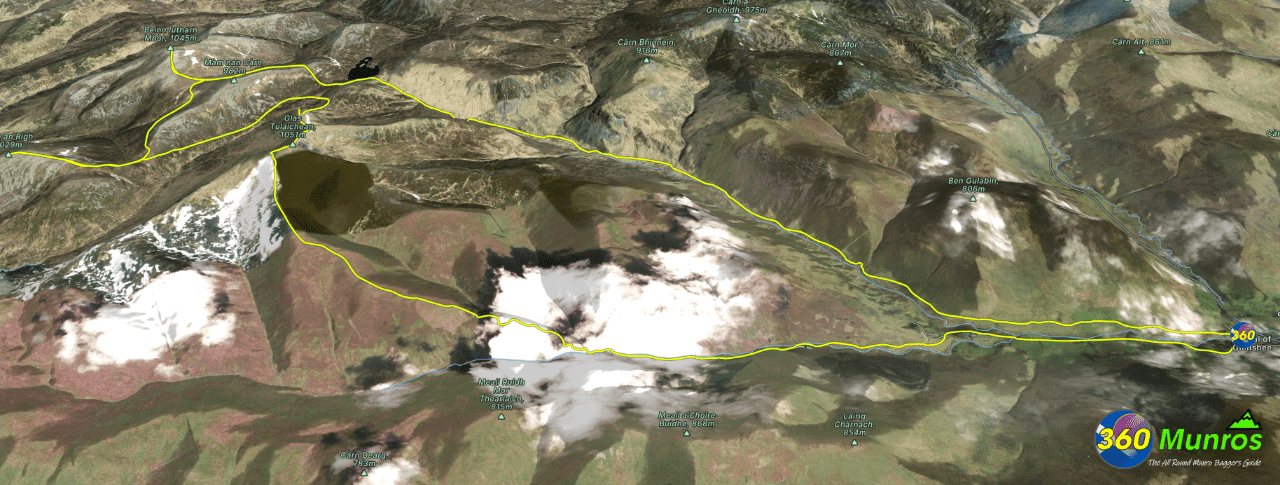
Glas Tulaichean, Carn an Righ & Beinn lutharn Mhor OS Route Map
View this route on an OS Map.
3D Model of the Glas Tulaichean Munros
Zoom in / out and pan around the 3D model below.
The red line on the 3D model shows the route.
Can take a few seconds to load.
