Gleouraich & Spidean Mialach
‘Roaring Noise’ & ‘Peak of the Clouds’
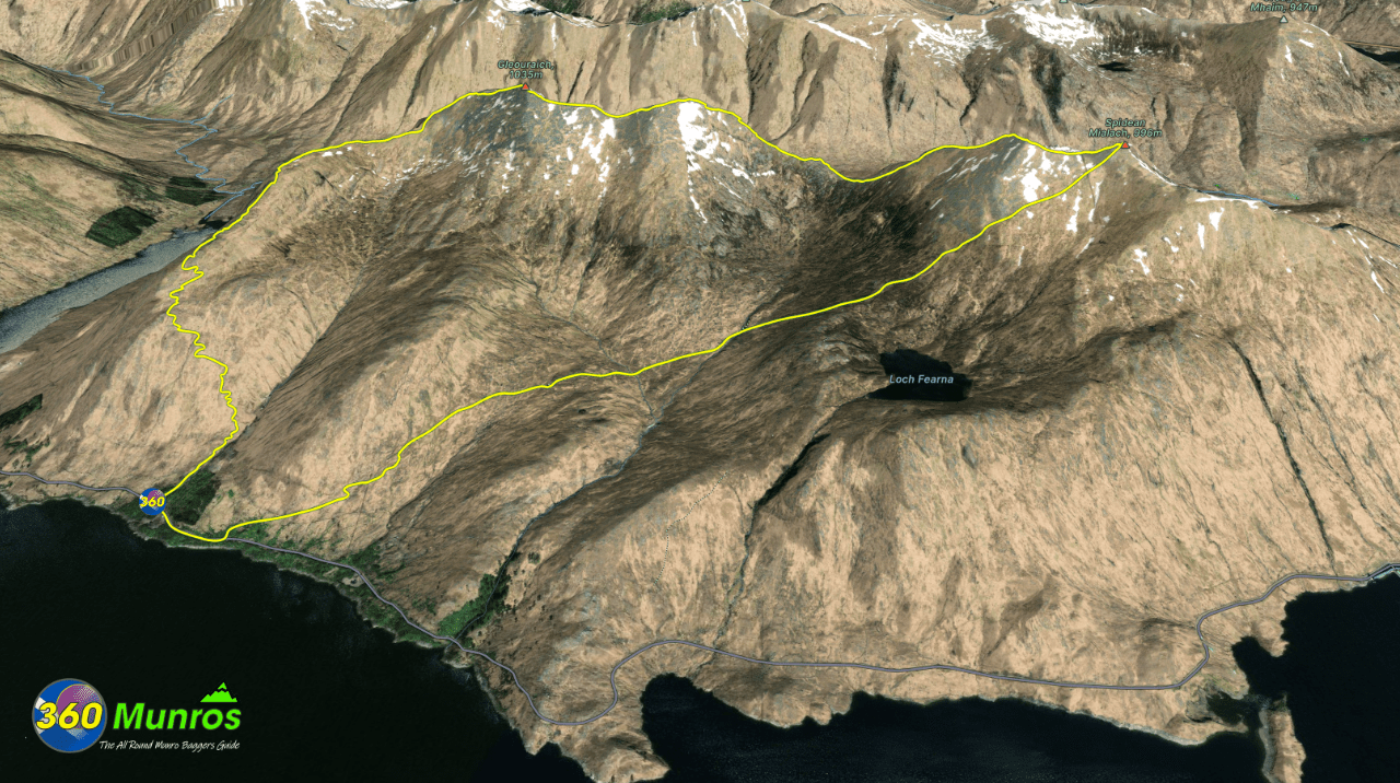
Two Munros rising above Loch Cuaich, linked by a sweeping ridge and steep rocky slopes. Their old stalkers’ paths make for an enjoyable circuit, with panoramic views deep into Knoydart to the west, Glenshiel ridge to the North and across the Highlands. Remote yet accessible from the roadside, they offer a classic West Highland adventure.
Route details with map, 3D model and GPX download of the route to the summit of these mountains in Scotland.
Munro – Gleouraich – Altitude: 1035 metres
Munro – Spidean Mialach – Altitude: 996 metres
Length: 7.3 miles Total Ascent: 3787 ft Surface: Rough/rocky/paths
Difficulty: Moderate
Average Walking Time: 5:00 h
Route starts at a small car park by the side of the road – 57°04’32.5″N 5°15’11.5″W, Invergarry.
Google maps directions to the route start can be found HERE
Gleouraich & Spidean Mialach
360° Virtual Tour
Click on the round 360 logo in the tour window below to move forward through the Munro route tour. Pan Around using your mouse or finger. Press the Map - Show/Hide button to see where you are on the route. The red photo location marker within the map points it's radar in the direction of the photos view. The compass within the tour window lets you know the direction of view and travel. If possible view on a VR Headset to feel like your there!
Maps - View - Print - GPX File Download
All routes on 360munros.co.uk are SUMMER Munro Bagging Routes.
Winter Munro routes with Ice/Snow can be extremely challenging and dangerous.
The downloading and use of GPX files or printing of maps from 360munros.co.uk by individuals or groups as a navigational aid is entirely at the risk of the user.
3D Model of Gleouraich and Spidean Mialach
3D model loading…… Internet speed dependant.
The red line on the 3D model shows the route.
Click on the 3D model to move around / zoom in out.
