Grey Corries Via Stob Ban
The Grey Corries are a range of mountains in the West Highlands of Scotland. The range includes several of Scotland’s highest peaks including a number of Munros. The range is bounded to the north by the great extent of Leanachan Forest beyond which is Glen Spean and the Great Glen, to the east by the defile of Lairig Leacach and to the south by upper Glen Nevis and the headwaters of the Abhainn Rath. The ridge continues westwards at a high level to join Aonach Beag, Aonach Mor, Carn Mor Dearg and Ben Nevis.
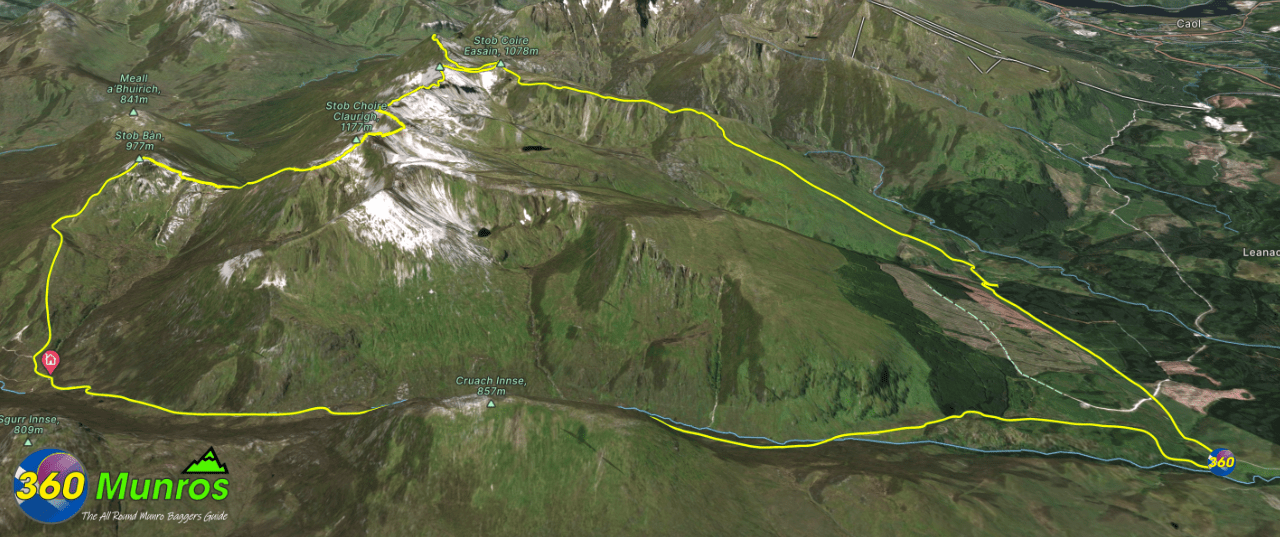
Route details with 360° virtual tour, map, 3D model and GPX download of the route to the summit of these mountains in Scotland.
Stob Ban – Altitude: 977 metres
Stob Choire Claurigh – Altitude: 1177 metres
Stob Coire an Laoigh – Altitude: 1116 metres
Sgùrr Chòinnich Mòr – Altitude: 1094 metres
Route Length: 15.5 miles Total Ascent: 5305 ft Surface: Varied/Rough/paths/pathless/road
Difficulty: Hard
Average Walking Time: 9:00 h
Route starts at Killiechonate, Spean Bridge PH34 4EY
There is vehicular access right up the dirt track to the start point on the map below.
Google maps directions to the route start can be found HERE
Grey Corries Via Stob Ban - 360° Virtual Tour
Click on the round 360 logo in the tour window below to move forward through the Munro route tour. Pan Around using your mouse or finger. Press the Map - Show/Hide button to see where you are on the route. The red photo location marker within the map points it's radar in the direction of the photos view. The compass within the tour window lets you know the direction of view and travel. If possible view on a VR Headset to feel like your there!
Maps - View - Print - GPX File Download
Grey Corries 3D Model View
3D model loading…… Internet speed dependant.
The red line on the 3D model shows the route
Click on the 3D model to move around / zoom in out.
