Maoile Lunndaidh
‘Bare Hill of the Wet Place’
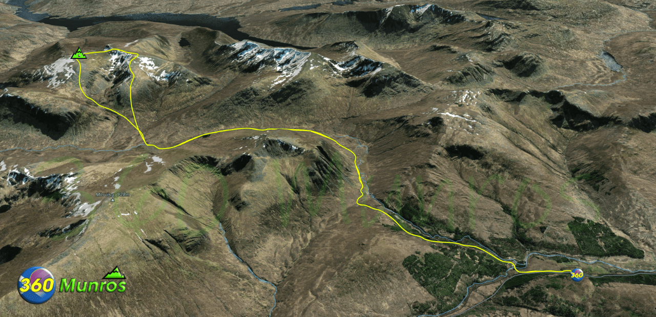
Route details with map, 3D model and GPX download of the route to the summit of this mountain in Scotland.
Maoile Lunndaidh – Altitude: 1007 metres
Length: 16.3 miles Total Ascent: 3914 ft Surface: Rough/pathless/road in
Difficulty: Hard
Route starts next to Gerry’s Hostel, Craig Achnashellach, Strathcarron IV54 8YU.
Google maps directions to the route start can be found HERE
360° Virtual Tour of this area coming soon.
Maps - View - Print - GPX File Download
All routes on 360munros.co.uk are SUMMER Munro Bagging Routes.
Winter Munro routes with Ice/Snow can be extremely challenging and dangerous.
The downloading and use of GPX files or printing of maps from 360munros.co.uk by individuals or groups as a navigational aid is entirely at the risk of the user.
3D Model of Maoile Lunndaidh
3D model loading…… Internet speed dependant.
The red line on the 3D model shows the route
Click on the 3D model to move around / zoom in out.
Sgurr Chonnich, Sgurr a Chaorachain, Maoile Lunndaidh
360° Virtual Tour
Maps - View - Print - GPX File Download
All routes on 360munros.co.uk are SUMMER Munro Bagging Routes.
Winter Munro routes with Ice/Snow can be extremely challenging and dangerous.
The downloading and use of GPX files or printing of maps from 360munros.co.uk by individuals or groups as a navigational aid is entirely at the risk of the user.
