Meall Corranaich and Meall a'Choire Lèith
‘Notched Hill’ & ‘Mountain of Gray Corries’
Route details with map, 3D model and GPX download of the route to the summit of these mountains in Scotland.
Munro – Meall Corranaich Altitude: 1069 metres
Munro – Meall a’Choire Lèith Altitude: 926 metres
Length: 6 miles Total Ascent: 2414 ft Surface: Grass/bog/path/Steep
Difficulty: Moderate
Average Walking Time: 3:40 h
This route starts at the north end of Lochan na Lairige. There is a small car park at the side of the road.
Google maps directions HERE
These Munros can be walked as part of the Ben Lawers Traverse Route.
Maps - View - Print - GPX File Download
Meall Corranaich
Via Sròn Dhà Mhurchaidh
360° Virtual Tour
Click on the round 360 logo in the tour window below to move forward through the Munro route tour. Pan Around using your mouse or finger. Press the Map - Show/Hide button to see where you are on the route. The red photo location marker within the map points it's radar in the direction of the photos view. The compass within the tour window lets you know the direction of view and travel. If possible view on a VR Headset to feel like your there!
Loading...
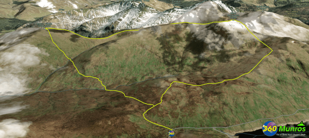
3D Model of the Ben Lawers Munros
3D model loading…… Internet speed dependant.
The red line on the 3D model shows the route.
Click on the 3D model to move around / zoom in out.
