Mullach Clach a' Bhlàir & Sgòr Gaoith
‘Summit of the Stony Plain’ & ‘Peak of the Wind’
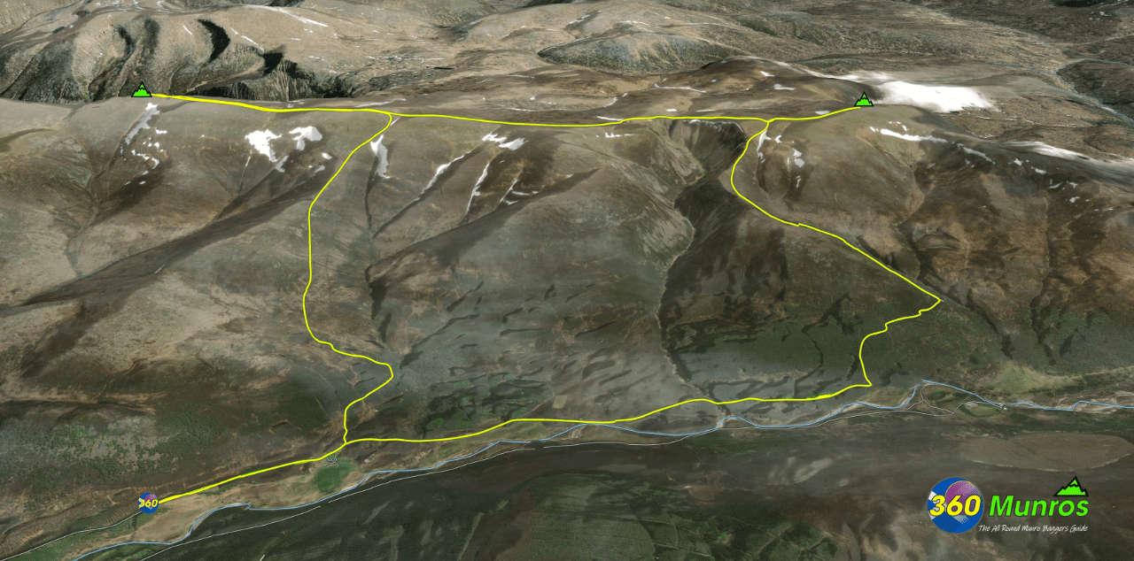
Route details with 360° virtual tour, map, 3D model and GPX download of the route to the summit of these mountains in Scotland.
Munro – Mullach Clach a’ Bhlàir – Altitude: 1019 metres
Munro – Sgòr Gaoith – Altitude: 1118 metres
Route Length: 16 miles Total Ascent: 3236 ft Surface: Rough/paths/road
Difficulty: Moderate
Average Walking Time: 7:30 h
Route starts at Achlean, Glen Feshie, Kingussie PH21 1NX
Google maps directions to the route start can be found HERE
Mullach Clach a' Bhlàir & Sgòr Gaoith
360° Virtual Tour
This Virtual Tour around these Western Cairngorm Munros starts at the car park at Achlean, Glen Feshie.
The south westerly winds were quite gusty on the day of photography, hence some photos are a little blurry. The route taken was anti clockwise to get the wind on our back while high up on the mountain plateau.
Click on the round 360 logo in the tour window below to move forward through the Munro route tour. Pan Around using your mouse or finger. Press the Map - Show/Hide button to see where you are on the route. The red photo location marker within the map points it's radar in the direction of the photos view. The compass within the tour window lets you know the direction of view and travel. If possible view on a VR Headset to feel like your there!
Maps - View - Print - GPX File Download
All routes on 360munros.co.uk are SUMMER Munro Bagging Routes.
Winter Munro routes with Ice/Snow can be extremely challenging and dangerous.
The downloading and use of GPX files or printing of maps from 360munros.co.uk by individuals or groups as a navigational aid is entirely at the risk of the user.
3D Model of Mullach Clach a' Bhlàir & Sgòr Gaoith
3D model loading…… Internet speed dependant.
The red line shows the route.
Click on the 3D model to move around / zoom in out.
