Sgùrr a Mhadaidh and Sgùrr a Ghreadaidh
‘Peak of the Fox’ & ‘Peak of Torment’
Route details, virtual tour with map, 3D model and GPX download of the route to the summit of these mountains in Scotland.
Munro – Sgùrr a Mhadaidh – Altitude: 918 metres
Munro – Sgùrr a Ghreadaidh – Altitude: 973 metres
Route Length: 6 miles Total Ascent: 3600 ft Surface: Paths/Pathless/Scree/Rock
Difficulty: Hard/Scrambling required.
Some areas of dangerous exposure, see 360° virtual tour below for details.
Average Walking Time: 6:30 h
This route starts at Glenbrittle Youth Hostel, Glenbrittle, Carbost, Isle of Skye IV47 8TA
Google maps directions to the route start can be found HERE
Sgùrr a Mhadaidh and Sgùrr a Ghreadaidh
360° Virtual Tour
Click on the round 360 logo in the tour window below to move forward through the Munro route tour. Pan Around using your mouse or finger. Press the Map - Show/Hide button to see where you are on the route. The red photo location marker within the map points it's radar in the direction of the photos view. The compass within the tour window lets you know the direction of view and travel. If possible view on a VR Headset to feel like your there!
Maps - View - Print - GPX File Download
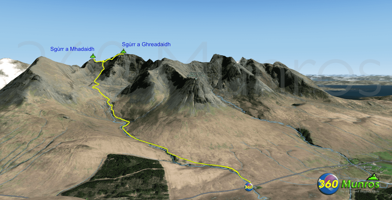
The map below shows the route to these mountains. There is a gpx file download of the route available under the map. The mountains on the Cuillin Ridge are extremely dangerous. The ground conditions are constantly changing with erosion rockfall etc, therefore DO NOT use the GPX file of the route below as exact lines. Use a mountain guide if inexperienced in these surroundings.
All routes on 360munros.co.uk are SUMMER Munro Bagging Routes.
Winter Munro routes with Ice/Snow can be extremely challenging and dangerous.
The downloading and use of GPX files or printing of maps from 360munros.co.uk by individuals or groups as a navigational aid is entirely at the risk of the user.
3D Model of the Cuillin Ridge with Sgùrr a Mhadaidh and Sgùrr a Ghreadaidh
3D model loading…… Internet speed dependant.
The red line on the 3D model shows the route.
Click on the 3D model to move around / zoom in out.
