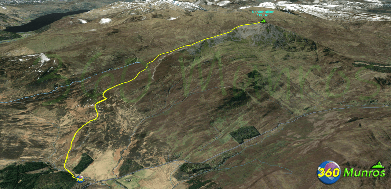
A popular mountain with hill walkers due to its accessibility, ease of ascent and views from its summit. Schiehallion is also a great introduction to the Munros for beginners as it has a good well maintained mountain path that if stuck to requires minimal navigation.. The route, which initially heads southwest before turning west to follow the main ridgeline of the hill, is about 5 kilometres (3 mi) in length to the summit.
Route details with 360° virtual tour, map, 3D model and GPX download of the route to the summit of this mountain in Scotland.
Schiehallion – Altitude: 1083 metres
Route Length: 6.3 miles Total Ascent: 2370 ft Surface: Varied/Rough/Good walkers path Difficulty: Moderate Average Walking Time: 3:50 h
Route starts at the Braes of Foss Car Park, 5NN, Pitlochry. The car park is quite big, but can be very busy at the weekend during the summer months. Google maps directions to the route start can be found HERE